
Explore how Quantum Cartography is reshaping intelligent mobility by mapping invisible flows of people, vehicles, and data. Discover the future of transportation with AI, IoT, and predictive analytics.
Introduction: Beyond Roads and Routes
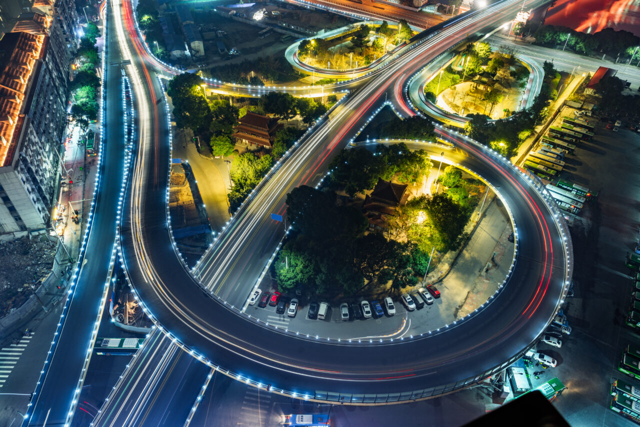
Modern cities aren’t just concrete landscapes they are living organisms where people, vehicles, and data constantly flow. Yet, most of these flows remain invisible to the naked eye. Enter Quantum Cartography, a transformative approach that applies advanced AI, IoT, and quantum-inspired models to map these hidden patterns.
By unlocking these invisible flows, intelligent mobility ecosystems can predict congestion, optimise public transport, and reduce emissions. According to McKinsey, smart mobility solutions could reduce travel time in cities by 15–20% by 2030.
What is Quantum Cartography?
At its core, Quantum Cartography is the science of mapping and analysing multidimensional mobility flows not just cars on roads, but pedestrians, bicycles, drones, logistics vehicles, and even digital data packets.
Unlike traditional traffic management, which relies on visible infrastructure like traffic lights and GPS signals, quantum cartography explores probabilistic patterns:
- How commuters choose alternate routes during peak hours.
- How ride-hailing fleets reposition in anticipation of demand.
- How micro-mobility options (e-scooters, e-bikes) cluster around hotspots.
This invisible flow mapping provides the foundation for intelligent mobility systems that adapt in real time.
The Invisible Flows of Intelligent Mobility
In cities, the visible system is just the surface roads, metros, and buses. The invisible layer contains the true dynamics:
- People Flows – Pedestrian density near workplaces, schools, and retail hubs.
- Vehicle Flows – Real-time interactions of cars, buses, and trucks across dynamic routes.
- Data Flows – GPS, payment systems, ride-hailing apps, and smart tickets feeding back into the ecosystem.
- Energy Flows – Charging demand for electric vehicles (EVs) across smart grids.
When mapped through Quantum Cartography, these flows reveal optimisation points that were previously impossible to identify. For example, a European city pilot using AI traffic signals reduced congestion by 25% and emissions by 10% within two years (European Commission, 2023).
How Quantum Cartography Powers Intelligent Mobility
- Predictive Traffic Management
AI and quantum-inspired models predict congestion before it happens, enabling preemptive rerouting.
- Seamless Multimodal Transport
Invisible flows help balance load between buses, metros, and shared mobility providers.
- Energy Efficiency for EVs
Mapping charging station demand prevents grid overload, supporting the expected 229 million EVs by 2030 (IEA).
- Safety Enhancements
Smart mobility ecosystems detect accident-prone zones by analysing invisible patterns in speed and pedestrian activity.
Human-Centric Benefits of Invisible Flow Mapping
- Time Savings: A study by INRIX found that drivers in congested cities lose up to 97 hours annually in traffic. Quantum Cartography can cut this significantly.
- Reduced Carbon Footprint: Intelligent routing reduces unnecessary fuel consumption, with potential CO₂ reduction of 20–30% in dense urban corridors.
- Accessibility: Mapping invisible flows improves urban planning, ensuring underserved areas get better transport connectivity.
- Personalized Journeys: Mobility-as-a-Service (MaaS) platforms use invisible flow data to provide commuters with personalized, real-time travel suggestions.
In this sense, intelligent mobility is not just about efficiency it’s about creating inclusive, sustainable, and human-focused urban ecosystems.
Challenges on the Road to Quantum Cartography
- Data Privacy: With sensors and apps tracking movement, privacy protection becomes critical.
- Integration Gaps: Cities often have fragmented transport authorities, limiting data sharing.
- Infrastructure Costs: Deploying IoT sensors, 5G networks, and digital twins requires significant investment.
Still, cities like Singapore and Helsinki are already pioneering invisible flow mapping, proving that with the right governance, Quantum Cartography is practical today not tomorrow.
The Future: From Invisible to Predictable
The promise of Quantum Cartography lies in turning invisible flows into predictive blueprints for cities. Imagine:
- A smart bus arriving before you even check the schedule.
- EV charging slots allocated before your car signals low battery.
- Pedestrian crossings that light up dynamically as crowds approach.
This is the future of intelligent mobility ecosystems a seamless, responsive, and sustainable network where every flow is mapped, predicted, and optimised.
Conclusion: A Map for Tomorrow’s Cities
Quantum Cartography goes beyond traditional maps it’s a navigation system for the future of intelligent mobility. By revealing invisible flows of people, vehicles, energy, and data, it builds the sealed blueprint for cities that are safer, greener, and more human-centric.
As urban populations rise projected to hit 68% of the global population by 2050 (UN, 2022) cities cannot afford to ignore invisible flows. The next decade will determine whether mobility systems remain reactive or evolve into proactive, predictive ecosystems.
And that evolution begins with Quantum Cartography.