
Urban planning is no longer just about zoning, roads, and concrete. In today’s fast-evolving cities, data, digital tools, citizen insights, and sustainable systems. The cities of tomorrow aren’t being designed on static blueprints they’re being modeled, simulated, and optimized with technology at the core.
As urban populations rise and infrastructure demands grow complex, the only way to plan smarter, faster, and more sustainably is to integrate technology directly into the DNA of urban planning.
Why Traditional Planning No Longer Works
Historically, city planning was slow, manual, and often reactive. Planners worked with limited data, fragmented tools, and siloed departments. The result? Overcrowded roads, inefficient land use, poor public transport connectivity, and infrastructure that lags behind citizen needs.
But today’s challenges climate change, rapid urbanization, energy crises, and real-time citizen expectations demand something more dynamic. Urban planning must now be:
- Proactive rather than reactive
- Data-informed, not just expert-opinion based
- Integrated across departments, not siloed
- Citizen-centric, not one-size-fits-all
That’s where tech-driven urban planning steps in.
What Is Tech-Driven Urban Planning?
Tech-driven urban planning leverages data analytics, simulation models, AI, GIS (Geographic Information Systems), and IoT insights to design, test, and refine city development plans in real time.
It shifts the paradigm from “plan and wait” to “plan, simulate, optimize, and execute.” This means:
- Using satellite and sensor data to map land use, air quality, and traffic patterns.
- Running predictive models to test the impact of new highways, zoning laws, or green spaces.
- Integrating citizen feedback through digital platforms to make inclusive decisions.
- Managing utilities, resources, and public assets more efficiently with real-time insights.
Key Technologies Powering the New Era of Urban Planning
- GIS and Mapping Platforms
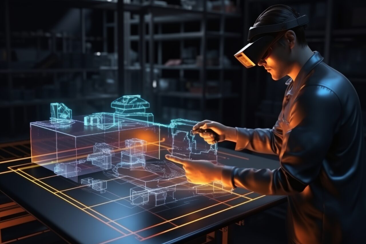
These tools allow planners to visualize topography, infrastructure, water lines, demographic clusters, and more all in a layered, interactive way. GIS has become the foundation of most urban development projects. - Digital Twins
By creating a virtual replica of a city or a zone, planners can test various “what-if” scenarios before committing to physical development. Want to know how a new metro line affects foot traffic, air quality, or noise? A digital twin can simulate it. - AI and Predictive Analytics
AI algorithms process massive datasets from traffic sensors to weather trends to offer forecasts and decision support. Predictive models can suggest the best locations for schools, hospitals, or EV charging stations based on future population patterns. - IoT Sensors
Smart poles, surveillance cameras, air monitors, and waste bins constantly feed real-time data. This helps planners make evidence-based decisions on where to invest and how to optimize urban services. - Citizen Engagement Platforms
Tech makes participation easy. Cities now use apps, QR-based surveys, or online dashboards to gather public input. This ensures that urban planning is not just for the people, but with the people.
Benefits of Tech-First Urban Planning
Faster Project Approvals: Tech cuts red tape by providing real-time data, reducing the time taken for feasibility reports and environmental clearances.
Reduced Costs & Wastage: Simulations ensure resources are allocated efficiently, and mistakes are caught early before cement is poured.
Improved Resilience: Planners can model for floods, heatwaves, and emergencies making infrastructure climate-adaptive.
Greater Transparency: Stakeholders, from citizens to contractors, get access to shared platforms and dashboards, ensuring trust and accountability.
Scalable Growth: Cities can plan modularly, and scale infrastructure as needs grow without starting from scratch.
Real-World Example: Tech in Action
Imagine a city planning a new residential zone near an industrial area. Instead of relying solely on maps and land surveys, planners can:
- Use air quality sensors to identify pollution hotspots.
- Simulate traffic congestion using digital twins.
- Predict peak water and electricity demand using AI models.
- Engage nearby residents via a feedback app to learn local concerns.
- Finalize the design based on real-time and forecasted data, ensuring better livability.
Challenges and the Way Forward
While the advantages are clear, the shift to tech-driven planning is not without challenges:
- Digital literacy gaps in local planning bodies.
- Initial investment and infrastructure needs.
- Interdepartmental data silos that limit collaboration.
But with strategic partnerships, capacity building, and support from urban-tech firms like astrikos.ai, cities can overcome these barriers and unlock long-term gains.
Conclusion: Planning Tomorrow with Today’s Technology
Urban planning is no longer about just “developing land” it’s about designing experiences, resilience, and inclusivity. With the right technologies, even mid-sized municipalities can achieve global standards of livability and efficiency.
At astrikos.ai, we empower urban leaders with AI-powered dashboards, real-time monitoring tools, digital twins, and data-driven insights that make modern city planning possible—affordable, flexible, and scalable.
Because a smarter city starts with smarter planning.